Our Stories
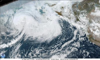
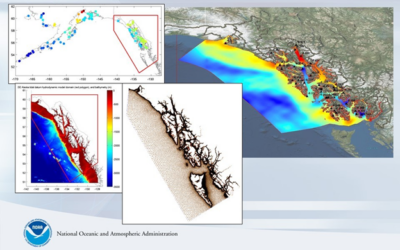
Ex-Typhoon Merbok Post-Storm Data Response
Extratropical Typhoon Merbok transited the Bering Sea impacting 40 Alaska Native communities and more than 1,300 miles of coastline. Visit this site to see the story about the post-storm data collection effort that was immediately coordinated to provide documentation...
What Was the Biggest Flood We Had?
The Alaska Division of Geological & Geophysical Surveys works with Alaska Water Level Watch partners to maintain photos and resources on historical floods in western Alaska. These resources are the only insights into how high past floods reached in and around communities and what kind of impact floods have had.
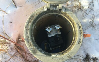
Water Level Sensor Installed to Monitor Flooding at Kwigillingok
Early in spring of 2021, the community of Kwgillingok experienced coastal flooding from a high tide (see https://www.kyuk.org/post/kwigillingok-experiences-severe-tidal-flooding). Although Kwigillingok has had coastal flooding in the past (see...
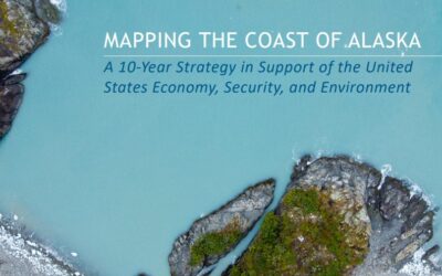
Alaska Coastal Mapping Strategy Supports Addressing Deficiencies in Water Level Network
The Alaska Mapping Executive Committee (AMEC)—a coordinated working group amongst federal agencies as well as the State of Alaska—recently released a strategy to map the coast of Alaska over the next 10 years. The strategy primarily addresses improvements to...
VDatum Efforts in Alaska
Southeast Alaska Model Release/Update The VDatum 4.0.1 release on October 28, 2019 includes support for transformations involving the tidal datums of southeast Alaska (SE AK): local mean sea level (LMSL), mean lower low water (MLLW), mean high water (MHW), mean higher...
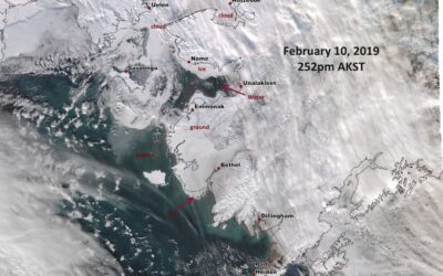
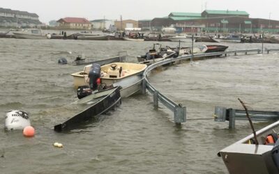
Coastal Storm Hits Western Alaska. In February.
February is not a normal time of year for coastal storms to be flooding western Alaska. With another year of record low sea ice extents in the Bering Sea (NSIDC, 2019), however, the coast remains vulnerable to low-pressure systems moving across the ocean.
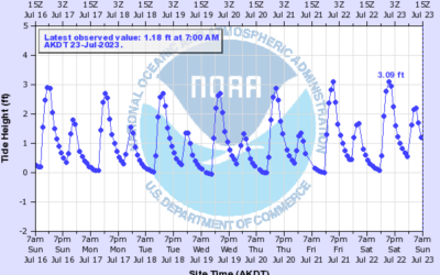
Summer Surge on Kotzebue Sound
In July 2018, the Alaska Division of Geological & Geophysical Surveys Coastal Hazards Program conducted coastal surveys at Kotzebue and Deering, Alaska to inform the elevation data used to create color-indexed flood communication maps. While surveying in Kotzebue, the program staff observed a summer storm surge which occurred over the course of July 17-18.
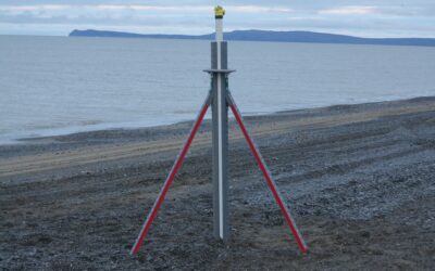
UAF Deploys Storm Surge Monitoring Tripods in Three Northwest Coastal Communities
Northwest Alaska is no stranger to large fall storms. From October until the sea ice arrives, the region experiences multiple coastal storms each year that heavily impact the region leading to inundation and coastal erosion. In September 2017, UAF deployed beach...
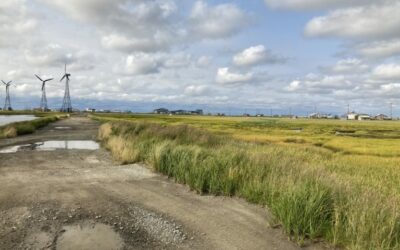
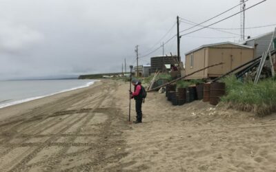
JOA Surveys Installs Storm Response Water Level Sensors on Yukon Delta
The 2017 fall storm season is already underway. Two storms impacted communities on the western coast in October, and extended storm activity impacted the Bering Straits and Norton Sound in early November. Storms that regularly occur during the fall season are...
Re-installation of the Tununak iGage
Alaska Division of Geological & Geophysical Surveys and Anchorage National Weather Service (NWS) staff travelled to Tununak to re-install a water level sensor that was damaged in winter of 2015.